

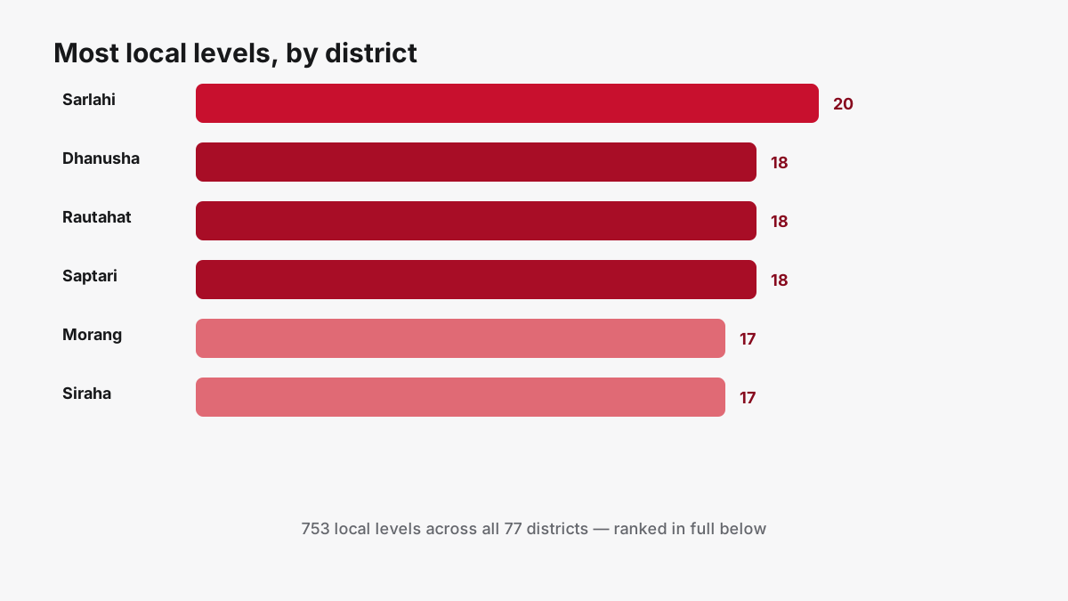
Sarlahi has more local levels than any other district in Nepal: 20, spread across 11 municipalities and 9 rural municipalities. That's more than six times what Eastern Rukum has, at the opposite end with just 3. Across all 77 districts, the average is roughly 10 local levels each, but the real distribution is lopsided, and not for the reason most people guess. It isn't about how big a district is. Kailali, one of the largest districts in the country by land area, has 13 local levels. Mustang, an even larger district, has only 5. The number tracks population and settlement pattern far more than it tracks the map, and the gap between the top and bottom of this ranking is wide enough that it says something real about how unevenly Nepal's population is actually spread across its own terrain.
How the count actually works
Nepal's 753 local levels were created in a single restructuring exercise between 2014 and 2017, when a government-appointed commission dissolved the country's roughly 3,900 old Village Development Committees and municipalities and merged them into new, larger units under the 2015 constitution and the Local Government Operation Act, 2017. Each new unit was classified as a Metropolitan City, Sub-Metropolitan City, Municipality, or Rural Municipality, and every one of them sits inside exactly one of Nepal's 77 districts. Nationally, that restructuring produced 6 metropolitan cities, 11 sub-metropolitan cities, 276 municipalities and 460 rural municipalities, a total of 753, a figure that's stayed fixed since the 2017 local elections and is confirmed by the 2022 Nepalese local elections results and by Wikipedia's Municipalities of Nepal overview. Going from the old structure of 3,157 Village Development Committees plus 217 municipalities (3,374 units in total) down to 753 new local levels means each new unit absorbed, on average, around four and a half of the old ones, though that average hides enormous variation: some new municipalities swallowed a dozen or more small VDCs, while others in sparsely settled areas were barely reshaped at all. The commission didn't distribute those 753 units evenly across the 77 districts; it drew boundaries around population and existing settlement clusters, which is exactly why the ranking below looks the way it does.
The top 15 districts, ranked
| Rank | District | Province | Local levels | Wards | Headquarters |
|---|---|---|---|---|---|
| 1 | Sarlahi | Madhesh | 20 | 200 | Malangawa |
| 2 | Dhanusha | Madhesh | 18 | 169 | Janakpur |
| 2 | Rautahat | Madhesh | 18 | 157 | Gaur |
| 2 | Saptari | Madhesh | 18 | 164 | Rajbiraj |
| 5 | Morang | Koshi | 17 | 159 | Biratnagar |
| 5 | Siraha | Madhesh | 17 | 164 | Siraha |
| 7 | Bara | Madhesh | 16 | 167 | Kalaiya |
| 7 | Rupandehi | Lumbini | 16 | 155 | Siddharthanagar |
| 9 | Jhapa | Koshi | 15 | 131 | Bhadrapur |
| 9 | Mahottari | Madhesh | 15 | 138 | Jaleshwar |
| 11 | Parsa | Madhesh | 14 | 112 | Birgunj |
| 12 | Dhading | Bagmati | 13 | 104 | Nilkantha |
| 12 | Kailali | Sudurpashchim | 13 | 126 | Dhangadhi |
| 12 | Kavrepalanchok | Bagmati | 13 | 135 | Dhulikhel |
| 15 | Bajhang | Sudurpashchim | 12 | 94 | Jayaprithvi |
Nine of these top 15 districts sit in the Terai, the flat southern plain along the Indian border, and six of them are in Madhesh Province alone, even though Madhesh has only 8 districts total out of the country's 77. Sarlahi's 20 local levels break down as 11 municipalities (Bagmati, Balara, Barahathwa, Godaita, Harion, Haripur, Haripurwa, Ishworpur, Kabilasi, Lalbandi and Malangwa) and 9 rural municipalities, a split independently listed by Wikipedia's Sarlahi District entry and matching the figures in our own directory dataset exactly.
Why Terai districts cluster at the top
The pattern isn't a coincidence. The Terai plain holds the majority of Nepal's population, 53.6% per the 2021 census as covered in our districts of Nepal guide, packed into flat, easily farmed land that was historically divided into many small VDCs long before the 2017 restructuring. When the local level commission merged those VDCs into new municipalities and rural municipalities, it worked from population and existing administrative boundaries as its starting point, not raw land area. A densely populated Terai district with dozens of old VDCs to merge naturally split into more new local levels than a hill or mountain district covering the same or greater area with a fraction of the population. That's the mechanism behind Sarlahi, Dhanusha, Rautahat, Saptari and Siraha, all Madhesh districts, filling five of the top six spots, with Morang (also a Terai district, in neighboring Koshi Province) rounding out the top tier.
The other end of the list
| District | Province | Local levels | Wards | Headquarters |
|---|---|---|---|---|
| Myagdi | Gandaki | 6 | 45 | Beni |
| Terhathum | Koshi | 6 | 43 | Myanglung |
| Western Rukum | Karnali | 6 | 73 | Musikot |
| Kaski | Gandaki | 5 | 72 | Pokhara |
| Mustang | Gandaki | 5 | 25 | Jomsom |
| Rasuwa | Bagmati | 5 | 27 | Dhunche |
| Bhaktapur | Bagmati | 4 | 38 | Bhaktapur |
| Manang | Gandaki | 4 | 28 | Chame |
| Mugu | Karnali | 4 | 45 | Gamgadhi |
| Eastern Rukum | Lumbini | 3 | 31 | Rukumkot |
Eastern Rukum, the lowest of all with just 3 local levels, is a small, hill-and-mountain district with a comparatively small population to divide. Manang and Mustang, both in Gandaki Province, are high-Himalayan districts where the entire district's population is smaller than a single ward in Sarlahi, so there simply wasn't enough population base to justify carving out many separate local levels. Bhaktapur and Kaski land at the bottom for a different reason entirely: both are compact, already-urbanized districts. Kaski's low count is largely because Pokhara Metropolitan City, one single local level, covers most of the district's population on its own, leaving little left to split into additional units.
It isn't about land area
Land area is a poor predictor on its own. Kailali district, at roughly 3,292 km², is one of the larger districts in the country and still ranks 12th nationally with 13 local levels. Mustang, at roughly 3,573 km², is larger still, yet has only 5. Dolpa, Nepal's largest district by area at about 7,889 km² (covered in our districts of Nepal guide), has just 8 local levels across its entire sprawling territory, fewer than Sarlahi packs into a district roughly one-sixth the size. Compare that to Bhaktapur, one of the smallest districts in the country at about 119 km², which still manages 4 local levels purely because of how dense its urban population is. Local level count tracks people, not square kilometers.
Nepal's local levels, the national totals
| Type | Count |
|---|---|
| Metropolitan cities | 6 |
| Sub-metropolitan cities | 11 |
| Municipalities | 276 |
| Rural municipalities | 460 |
| Total local levels | 753 |
| Total wards (all local levels) | 6,743 |
The 753 figure is independently confirmed by the sources linked above; the ward total is our own tally, summed across the per-district ward counts in the Nagarik Nepal directory, which is itself built from the same post-2015 federal restructuring records. For a deeper explainer on what separates a metropolitan city from a rural municipality, see our local levels of Nepal guide.
Find your own district
Every number in this ranking, plus the full name list of every local level in every district, is browsable in the Nepal local levels directory on this site, organized by province and district. The Nagarik Nepal app carries the same dataset offline, so you can look up your own district's local levels, wards, and headquarters without a data connection, and compare any two districts side by side.
Browse every district's local levels, wards and headquarters, fully offline.
Join the WaitlistSources: Municipalities of Nepal (Wikipedia), 2022 Nepalese local elections (Wikipedia), Sarlahi District (Wikipedia), Ministry of Federal Affairs and General Administration, Election Commission of Nepal, and per-district ward and local-level counts from the Nagarik Nepal app's own directory dataset.